You've been told to “get a feasibility study.” Here's what that actually means.
If you've been researching how to build on land in Washington, someone has probably told you to get a feasibility study. Maybe a realtor. Maybe a county planner. Maybe you read it in an article like this one.
But what does that actually involve? What are you paying for? And how is it different from a survey, an inspection, or just calling the county yourself? If you're still deciding whether you need one at all, read do I need a feasibility study first.
Here's the breakdown.
The core question a feasibility study answers
Can you build on this specific parcel, and if so, what will it take?
That's it. Everything in the feasibility study exists to answer that one question with actual evidence instead of guesswork.
What's actually evaluated
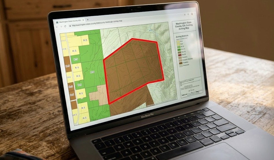
Zoning and land use verification
The study confirms your parcel's zoning designation and what it allows. This includes permitted uses, minimum lot size requirements, setback distances from all property boundaries, maximum building height, lot coverage limits, and any overlay zones that add restrictions.
Overlay zones are the ones that catch people off guard. A parcel might be zoned residential, but an overlay for scenic corridors, airport noise, or mineral resource lands can add restrictions that don't show up in the basic zoning code.
Septic or sewer evaluation
If the parcel doesn't have sewer service, the study evaluates whether an on-site septic system is viable. This includes reviewing any existing perc test data, evaluating soil conditions, checking setback requirements from wells and water features, and determining whether the lot has enough space for a drain field.
If sewer is available, the study verifies connection feasibility and any associated costs or requirements. Our septic services team handles the full evaluation.
Some counties in Washington require septic design approval before a building permit application is accepted. If the study identifies septic as a tight constraint, address it first. Don't wait until you're deep into design to discover the drain field location affects your floor plan.
Environmental and critical area review
Washington's Growth Management Act requires counties to protect critical areas. A feasibility study checks for wetlands, streams, steep slopes, flood zones, and habitat conservation areas on or near your parcel.
If critical areas are present, the study identifies what buffers apply and how they reduce your buildable footprint. It may also flag whether a formal wetland delineation, habitat assessment, or geotechnical report will be needed during permitting and coordination. Our team handles environmental reviews as part of this process.
Utility access assessment
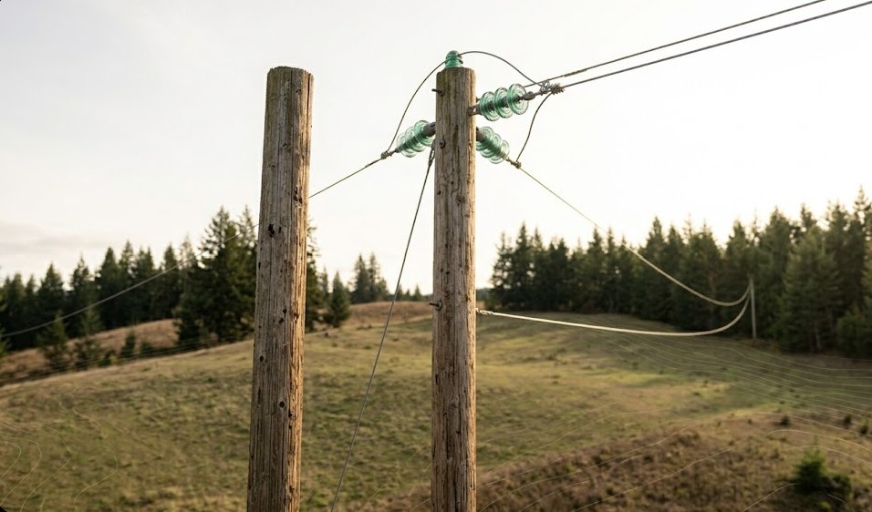
The study checks availability and proximity of electrical service, water (municipal or well), natural gas (if applicable), and internet or telecommunications.
For each utility, the key questions are: Is it currently available at the parcel? If not, how far is the nearest connection point? What's the estimated cost to extend service?
This is where rural parcels often hit budget surprises. A property 1,500 feet from a power line in rural Skagit County will have a very different utility cost than a lot on an established road in Tacoma.
Access and road evaluation
The study verifies legal access to the property. Does the parcel have public road frontage? If not, is there a recorded access easement? Does the road meet county standards for emergency access?
It also evaluates the condition of existing access. A gravel road that floods seasonally isn't the same as a paved county road. Improvement costs get factored in. Land surveys can confirm easement boundaries when access is in question.
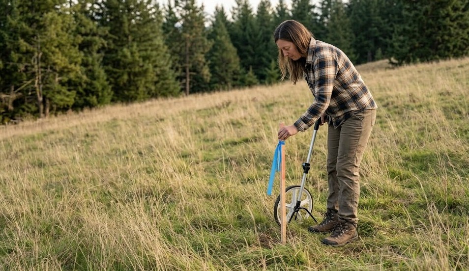
Slope, soil, and topographic analysis
Using available topographic data and, when needed, site observation, the study evaluates the general slope of the buildable area. Steep slopes trigger additional engineering requirements and may limit where a structure can be placed.
Soil type affects foundation design, drainage, and septic. If available soil data raises concerns, the study will recommend a geotechnical investigation.
Ask whether the feasibility study includes a site visit or relies solely on desktop data. Desktop reviews using GIS, aerial imagery, and county databases are useful, but some conditions — like drainage patterns, actual slope feel, and unmapped wetland indicators — only show up on the ground.
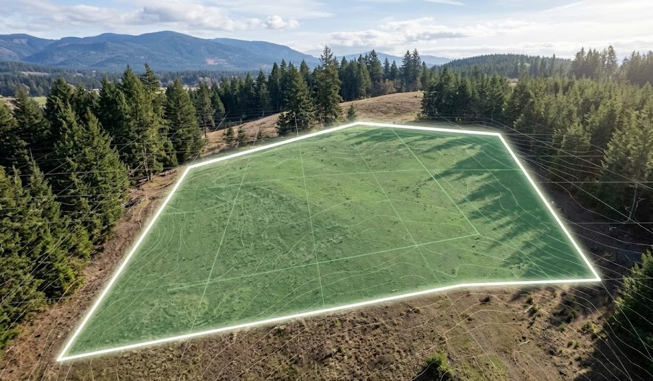
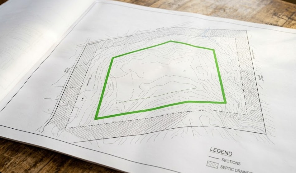
Setback and buildable envelope mapping
After accounting for all constraints — setbacks, easements, buffers, slope limitations — the study identifies where on the parcel you can actually place a building. This is your buildable envelope.
Sometimes this is generous. Sometimes it's a tight rectangle that barely fits a modest home. Knowing this before you hire an architect is the difference between an efficient design process and an expensive one.
What a feasibility study is not
It's not a survey, though it may reference survey data. It's not a geotechnical report, though it may recommend one. It's not an environmental impact statement. It's not a building permit.
It's a practical, evidence-based assessment that tells you where you stand. Think of it as the intelligence-gathering phase before you commit resources to design and permitting.
What you get at the end
A good feasibility study gives you a written report that covers each evaluation area with findings and recommendations. You should walk away knowing:
- Whether your parcel is buildable.
- What constraints exist and how they affect your project.
- What additional studies or approvals may be needed.
- A realistic sense of site-related costs.
- A clear picture of your buildable envelope.
That's the foundation for every decision that follows. Wondering about cost? Our guide on how much a feasibility study costs in Washington breaks it down.
How MKG Construction approaches feasibility
MKG Construction provides feasibility studies for landowners across Washington State. The process covers every element described above, tailored to your parcel's specific conditions and your county's specific requirements.
We don't do cookie-cutter reviews. Every parcel is different. A lot in Spokane Valley has different constraints than one on the Kitsap Peninsula. Our job is to evaluate yours and give you a clear, honest picture.
Milestone-based payments. No hidden fees. A real answer you can use to make your next decision with confidence.
Want to know exactly what a feasibility study would look like for your Washington property? MKG Construction evaluates your parcel's zoning, septic, utilities, access, slope, and environmental conditions, then gives you a clear written assessment. Milestone-based payments. No hidden fees.
Get started